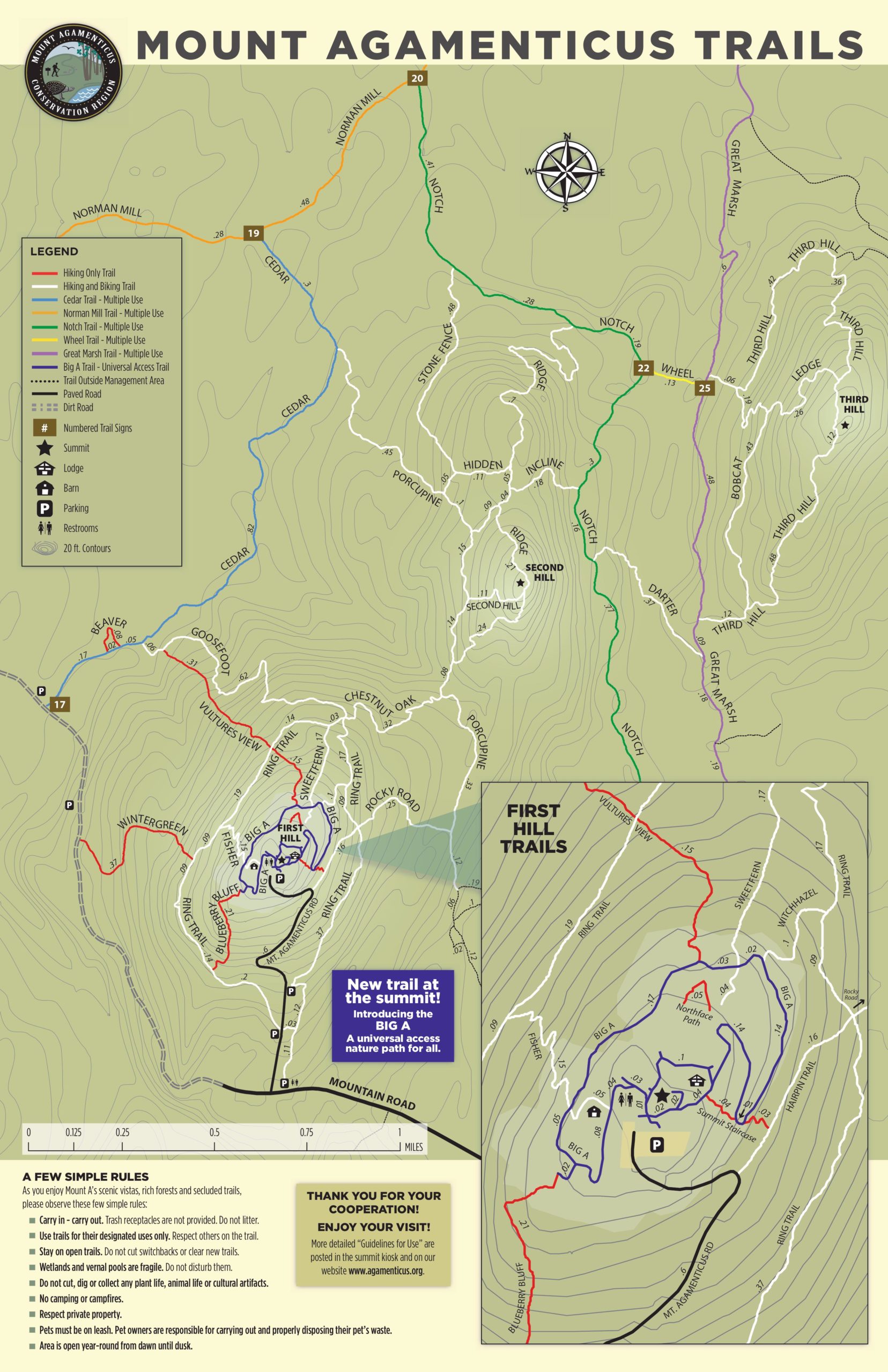
Looking for some good hiking and biking trails near York, Maine? Mount Agamenticus offers great trails and views – all within a 15 minute drive from Stage Neck Inn. Below is a Mt. Agamenticus trail map courtesy of agamenticus.org.
AllTrails also has a great resource that breaks some of the different trails down by duration, elevation gain, and more. Check out Best Trails in Mount Agamenticus Conservation Region for more information.
About the Mount Agamenticus Conservation Region
The Mount Agamenticus Conservation Region consists of more than 10,000 acres and is located within an additional 30,000 acre expanse of conservation land in southern Maine. This land is comprised of a rich and unique coastal forest that supports the highest diversity of animal and plant species in all of Maine. The mountain and the surrounding area provide residents with an ideal location for hiking, biking and sightseeing.
Mount A’s trails are for hikers, bikers, and other seasonal activities such as snowshoeing. Select trails are open to equestrians and ATV riders. As you travel the trails, we you’ll discover why this place is special. To ensure long-term trail quality and to protect against erosion, trails are designated for specific uses. Trail signs, color blazes and the trail map tell which uses are permitted on each trail.
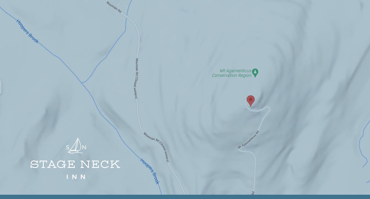
Directions to Mount Agamenticus
Below are directions to Mount Agamenticus from from both the North & South courtesy of the agamenticus.org website.
Directions to Mount Agamenticus from the North:
- Take I-95 South to Wells (exit 19).
- Turn left from exit onto route 109. Go 1 ½ to 2 miles to route 1.
- Turn right (south) onto route 1.
- Follow route 1 into Ogunquit and through “downtown.”
- At the flashing yellow light hanging over the road, turn right onto Agamenticus Road (turns into Clay Hill Road). Continue about 4 miles (crossing over the Maine Turnpike) to the T-intersection at the end.
- Turn right onto Mountain Road and follow it for about 1 mile.
- There is a gravel parking lot on the right and a paved road leading to the summit of Mount Agamenticus. Red fence posts at the entrance say “Mount A Summit.” If the road turns to gravel, you’ve gone a hundred meters too far. Turn right and drive up to the summit or park in the gravel lot to hike up. Trail maps are available at the trailheads and the kiosk located at the summit parking lot.
Directions to Mount Agamenticus from the South (using Rt. 1):
- Take I-95 North into Maine. Take Exit 7, York (the last exit before the tollbooth for the Maine Turnpike).
- Follow signs to Route 1 North (keeping right after the exit ramp). Turn left onto Route 1 North.
- Approximately 3.5 miles after turning onto Route 1, turn left on Mountain Road (Across from Flo’s Hotdog Stand).
- Follow Mountain Road for approximately 4 miles to a stop sign after crossing the interstate.
- Turn right and continue on Mountain Road for approximately two and a half miles from the interstate overpass.
- There is a gravel parking lot on the right and a paved road leading to the summit of Mount Agamenticus. Red fence posts at the entrance say “Mount A Summit.” If the road turns to gravel, you’ve gone a hundred meters too far. Turn right and drive up to the summit or park in the gravel lot to hike up. Trail maps are available at the trailheads.
Directions to Mount Agamenticus from Stage Neck Inn
Stage Neck Inn is an iconic destination where families and friends share delightful experiences that evolve into lifetime memories. Offering spacious accommodations with modern amenities and classic décor, breathtaking ocean and harbor views and the ocean’s relaxing sounds make for the perfect stay at our oceanfront resort in York Harbor, ME. Book your stay online now.